The issue

The city of Meppel is extending into a sensitive cultural landscape. A district half the size of the current city will be developed in the next 25 years. The plan needs to be respectful to the landscape, well connected with the city and produce a finished result in every phase.

Our statement

In New-Peat Lands everybody will live at a meadow, creating a district where city and landscape slide into each other.

Our solution

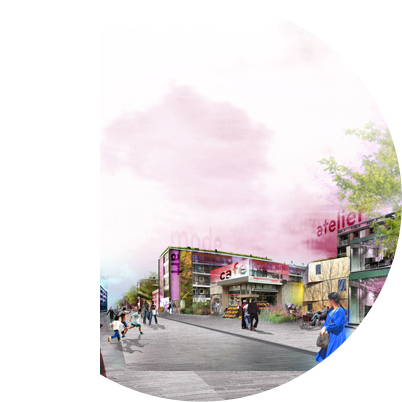
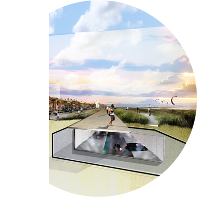
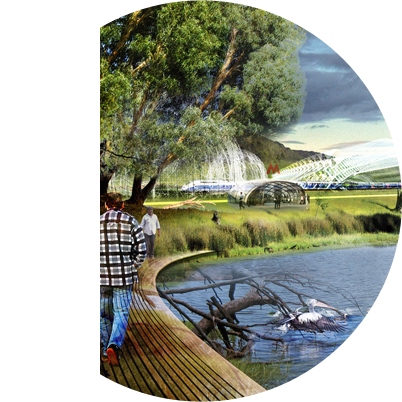
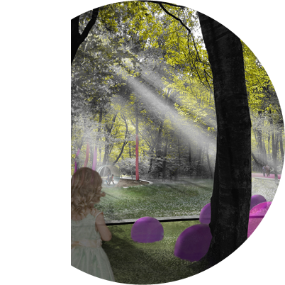
The typical cultivation pattern of the landscape is the base for the urban plan. Instead of the usual complete filling, we introduce an alternative civil engineering method. Thus we can retain all ditches, as base for both the urban water system and the development framework. Build-up parcels are alternated with agricultural meadow zones. Three distinct ribbons further elaborate the framework. Large-scale recreational facilities and a finely meshed network of paths join the city to the new district and the landscape.

Data
Client: City of Meppel
Location: Meppel, The Netherlands
Area: 737 ha.
Year: 2003-2005
Status: Ratified
Partners: OKRA landscape architects, Tauw environmental consultants, Goudappel Coffeng traffic engineers


More information? Click:

Nieuwveense Landen_Project Documentation

Nieuwveense Landen_Process & Scenario Game

Nieuwveense Landen_Master Plan Summary

or the pdf-icon at the bottom of this page.

The issue

The National Government aspires to put this area on the UNESCO World Heritage list. Therefore the archaeological values in the landscape need to be protected. Economical detriments need to be compensated within the landscape itself.

Our statement

The two historical layers, now blurred into each other, need to become separately readable. This opens up a whole new world of economical potentials.

Our solution

First we research the possibilities to protect the archaeology. Interactive with all stakeholders, we attune the archaeological ambitions to the acceptable level of new developments. With the outcome, we design a landscape framework, clarifying the rational land-claim. This hosts a set of story lines, illuminating the archaeology. Together they create a clear structure for adding wind turbines, increase recreational attraction and additional income, and thus free up space for the desired archaeological protection.

Data
Client: Province of Flevoland, with Lelystad City, Dronten Council, Farmers Coop. Swifterbant
Location: Flevoland, The Netherlands
Area: 38.2 km2
Year: 2003-2004
Status: Ratified
Partners: OKRA landscape architects


More information? Click:

Swifterbant_Project Documentation Swifterbant_Process & Scenario Game

or the pdf-icon at the bottom of this page.

The issue

For 300 years the cathedral square has been the trauma of the city. It is depressing and inhospitable, but the community is incapable to deal with changing it. A process of revealing the 2000-year history of the square should change the citizens’ perception. Marking the roman castellum wall is the first physical intervention, a test case for the whole operation.

Our statement

The mysterious referring to hidden pasts of the marking makes people curious, amazed and keep them intrigued, also when they pass it daily.

Our solution

History is a great inspiration. The original wall lies buried 4 meter below the surface. Its ruins were overgrown by woods in the middle ages. We design the marking with the exact measurements of the wall. Rusty corten steel refers to the soil and woods. The engraving shows map fragments of the boarders of the Roman Empire. Once an hour fog and green light rises from the marking, like a wall in mysterious swamp forest. On special days of the year the colour changes, adding to the festivity and keeping people surprised.

Data
Client: Domplein 2013 Foundation
Location: Utrecht, The Netherlands
Area: 149 m1
Year: 2006-2010
Status: Competition winner, Constructed
Budget: € 1.1 million
Partners: OKRA landscape architects, Rots Maatwerk


More information? Click:

Dom Square_Project Documentation

or the pdf-icon at the bottom of this page.