The issue
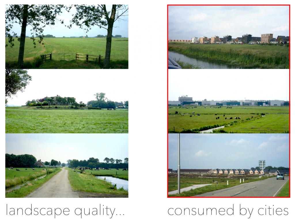
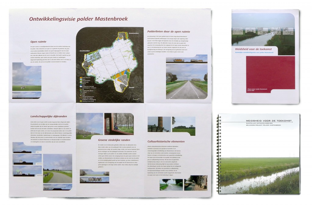
This unique medieval landscape of national cultural importance is gradually consumed by the surrounding cities. The province, three councils and water-board together commissioned a development-plan for the next 20 years.
Our statement
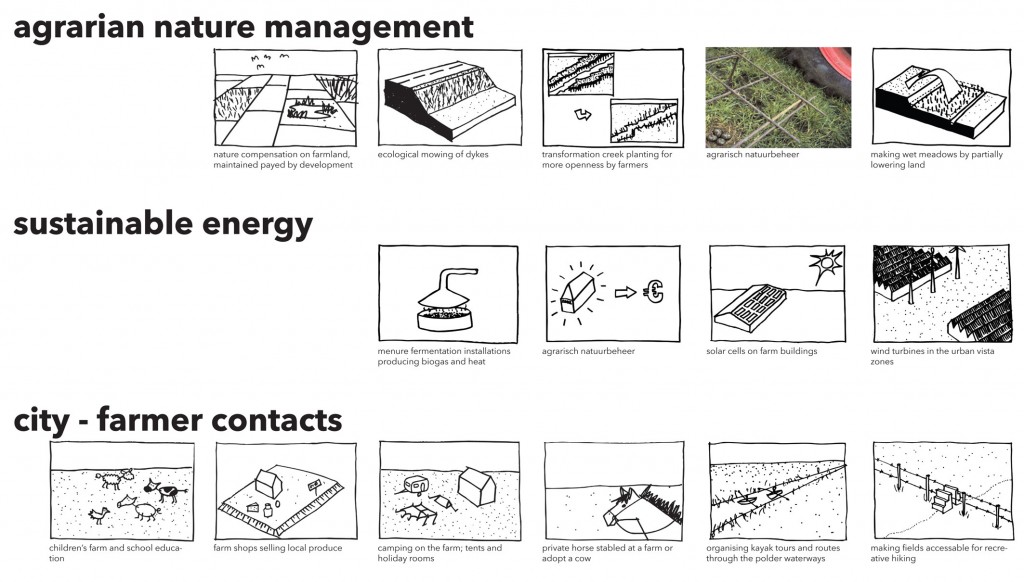
To preserve this extraordinary landscape, a new relation between cities and landscape, between ‘citizens’ and ‘farmers’ is needed.
Our solution
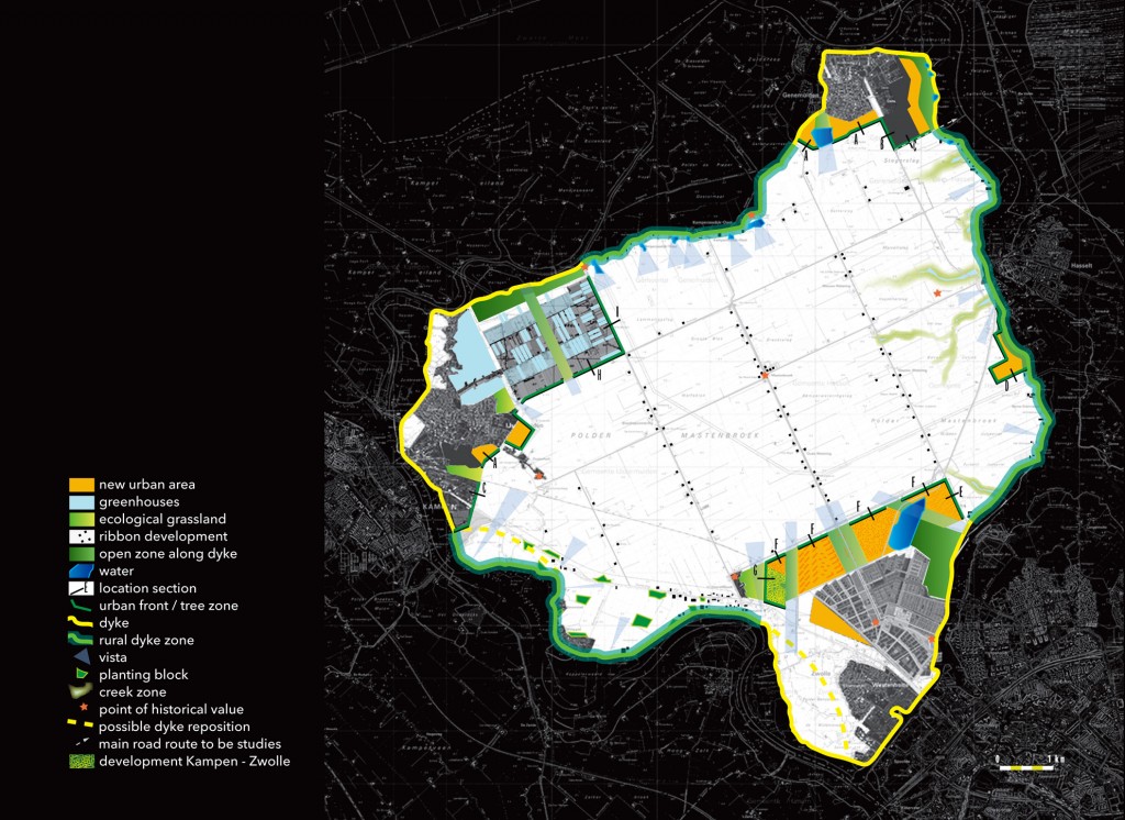
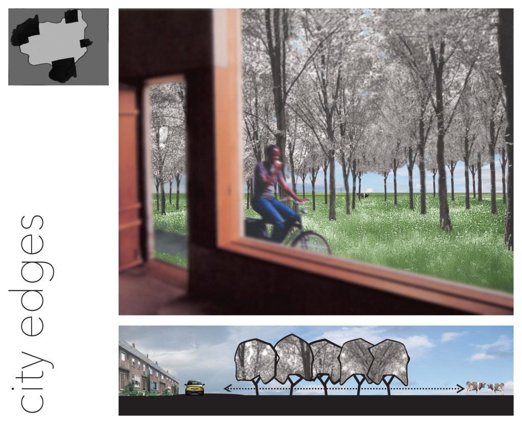
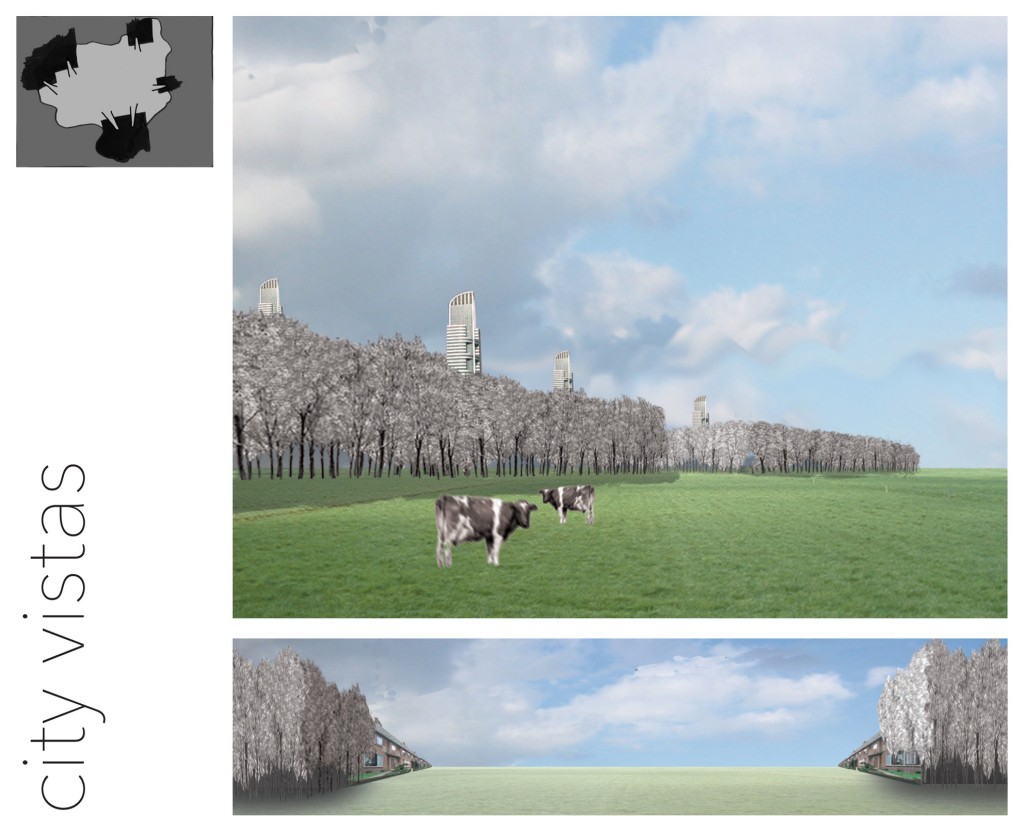
Together with stakeholders and rural communities we have developed a plan that brings cities and landscape in contact again. The cities transform their backsides into green fronts, viewing to the landscape. Recreational networks and rural programs invite the citizens into the landscape, making them allies in the preservation. Each party is made responsible for specific follow-up projects, keeping each other attentive.
Data
| Client: | Province of Overijssel, with Zwolle City, Kampen City, Zwartewaterland Council, Waterboard Groot Salland |
| Location: | Overijssel, The Netherlands |
| Area: | 99.8 km2 |
| Year: | 2001-2003 |
| Status: | Ratified |
| Partners: | Dolte Town Planning, OKRA landscape architects |
More information? Click:
Mastenbroek_Project Documentation
or the pdf-icon at the bottom of this page.